16 Things to Do in Peru: Which Places Are Worth Visiting?

Peru isn’t just Lima and Machu Picchu— this country is packed with unforgettable experiences. Picture epic hikes through jaw-dropping landscapes, ancient ruins steeped in history and mystery, charming towns bursting with local culture, and lakes so stunning you’ll think someone cranked up the saturation. Oh, and don’t forget that little green patch on the map—the Amazon Rainforest!
If you’re planning your Peru trip, this guide covers the top things to do in Peru along with my insider information on each of them. After exploring Peru in depth, I can say with confidence that it’s one of the most captivating destinations out there.
These are the spots I think you absolutely need to see when you visit Peru. Now, I’ll admit, there are a lot of them. Since the country is so vast and the distances so long, you’ll probably have to pick and choose which places to see on this trip—and which ones to leave for next time. Trust me, there will be a next time. Peru just does that to you—learn more about Peru.
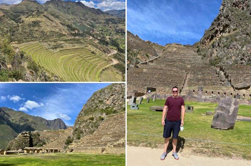
There are a lot of amazing places in Peru
Pro tip: If you’d rather have someone else do the planning, see my 2-week Peru itinerary. I’ve already make the decisions for you and it includes just the absolute top places Peru has to offer.

What are the top things to do in Peru?
- Machu Picchu—Explore Peru’s iconic Inca ruins atop a breathtaking mountain.
- Cusco—Discover a vibrant city filled with history, Inca ruins, and great food.
- Rainbow Mountain—Hike to colorful striped peaks with epic mountain views.
- Sacred Valley—Visit stunning landscapes and ancient sites in the heart of the Inca Empire.
- Paracas National Reserve—See desert meet ocean in this UNESCO World Heritage Site.
- Islas Ballestas—Spot sea lions, penguins, and birds on this wildlife-rich boat tour.
- Arequipa and Santa Catalina Monastery—Be blinded by Arequipa’s white elegance and visit colorful Santa Catalina Monastery.
- Huaraz—Hike in the Peruvian Andes to turquoise lakes and snowy peaks.
- Chan Chan—Walk through the largest ancient adobe city in the Americas.
- Iquitos—Gateway to the Peruvian Amazon Rainforest, only reachable by boat or plane.
- Pacaya Samiria—Visit the lush Amazon Rainforest full of exotic wildlife.
- Huacachina—Sandboard or relax at this tiny oasis surrounded by dunes.
- Lake Titicaca—Explore the world’s highest lake and its unique floating islands.
- Nazca Lines—Fly over Peru’s mysterious ancient geoglyphs.
- Colca Canyon—Visit one of the world’s deepest canyons and spot majestic Andean condors soaring above.
- Lima—Experience history, culture, and world-class food in Peru’s capital.
Sometimes, all you need to do is take the first step... I've filtered out the best hotels in Peru for you
Save it for yourself to come back to later, or share with your friends on social media!
I've already planned your ititnerary for the trip, complete with my travel tips.
Map of top things to do in Peru: Where are the best tourist attractions?
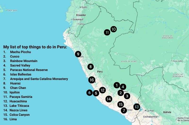
Most of the top things to do are in southern Peru
My top tips for visiting Peru:
- Machu Picchu is worth the hype. You have to go! Just make sure to book your tickets well in advance. Check out my Machu Picchu travel guide for tips on best time to go and logistics.
- Don’t miss Paracas National Reserve. It’s the most underrated place I visited in Peru, with stunning desert-meets-ocean landscapes.
- Altitude sickness is real. Many of Peru’s top spots are much higher than you’re used to. Spend a few days in Cusco, Arequipa, or Huaraz to acclimatize before tackling any (amazing!) hikes.
- Distances are vast. Internal flights save time but consider driving from Arequipa to Cusco—it’s a scenic route and helps with acclimatization.
- Ballestas Islands are overhyped. Only go if you’re really into speedboats, birds, and seals. Otherwise, skip it.
- Stay in international hotel chains for best value. Prices for luxury hotels in Peru are very budget-friendly, but local hotels aren’t up to standards. You’ll thank me for this nugget of knowledge when you’re hanging out at the rooftop pools in Lima’s Hilton Miraflores.
1. Hike Machu Picchu (with or without the Inca Trail), a UNESCO World Heritage Site
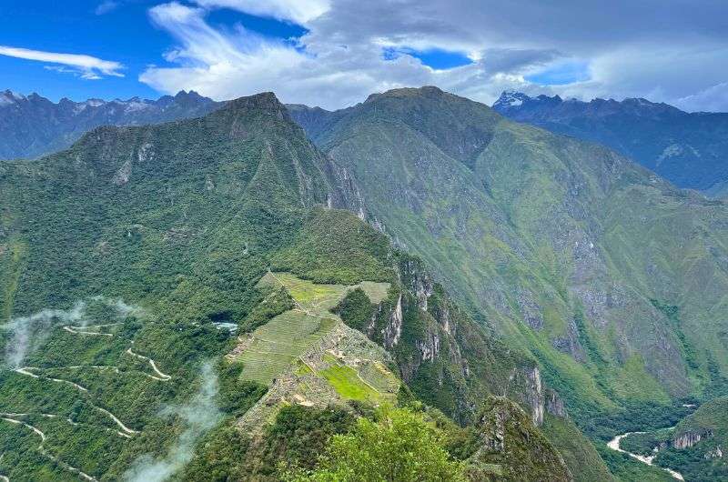
Number 1 is hands down Machu Picchu
Jan’s verdict: Machu Picchu, the Inca ruins on top of a mountain, is not a tourist trap, in case you were wondering. Because I was hesitant before I went. But nope! Machu Picchu is deservedly the top place to visit in Peru—very much bucket list material. The fact that getting there is a trip in itself doesn’t hurt, either!

The Inca city of Machu Picchu doesn’t need much introduction—you’ve all seen the photos. Walking its stone paths, you’ll encounter perfectly carved temples and agricultural terraces clinging to the mountainside. Surrounded by misty peaks that soar dramatically into the sky, the site exudes an otherworldly vibe.
Machu Picchu is the crown jewel of Peru, with ancient ruins atop a mountain offering phenomenal views. Getting there isn’t easy, adding suspense, adventure, and a fair amount of spending to the journey.
Inca Trail vs getting to Machu Picchu without hiking
I visited Machu Picchu without hiking, but many travelers opt for the famous Inca Trail, a four-day trek through mountain landscapes and Inca sites, ending at the Sun Gate for that iconic first view of the ruins.
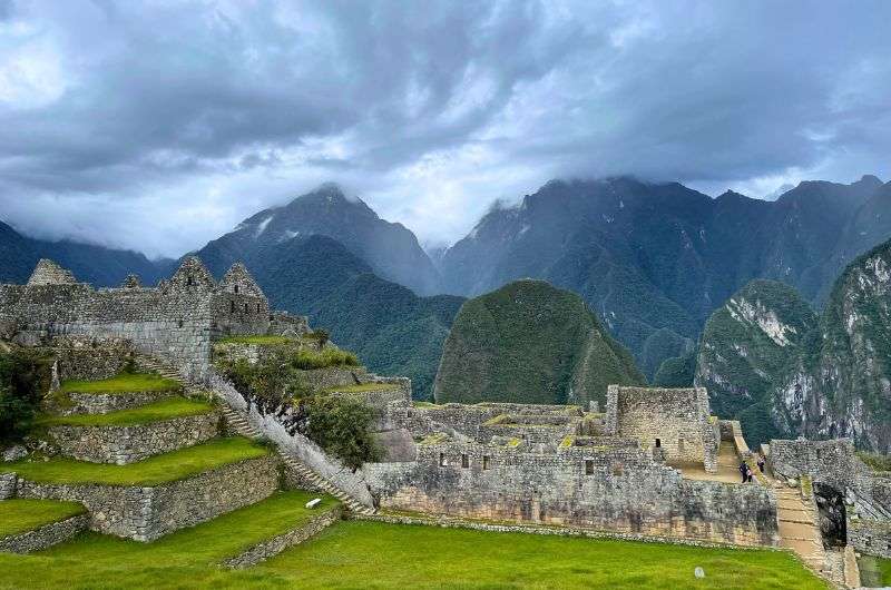
You will see a lot of Inca culture at Machu Picchu
Since I’m not into camping, I chose the classic route: driving from Cusco to Ollantaytambo, taking a scenic train to Aguas Calientes, and then hopping on an overpriced bus up to the ruins.
Once at Machu Picchu, there are several hikes to nearby peaks, each offering unique perspectives of the ruins. I took the Huayna Picchu hike, a steep, narrow, and thrilling climb featuring the infamous "Stairs of Death." Sure, it’s a bit hair-raising, but those views of Machu Picchu are worth every step.
For me, this 2–3-hour adventure beats the long slog of the Inca Trail any day.
How to visit Machu Picchu
In 2024, Machu Picchu introduced 3 main circuits with 10 distinct routes to enhance the visitor experience and preserve the site. These circuits—Panoramic, Classic, and Royalty—offer different perspectives of the citadel. Check out my Guide to Visiting Machu Picchu for details.
Tickets must be booked up to six months in advance if you’re visiting in high season (June–August).
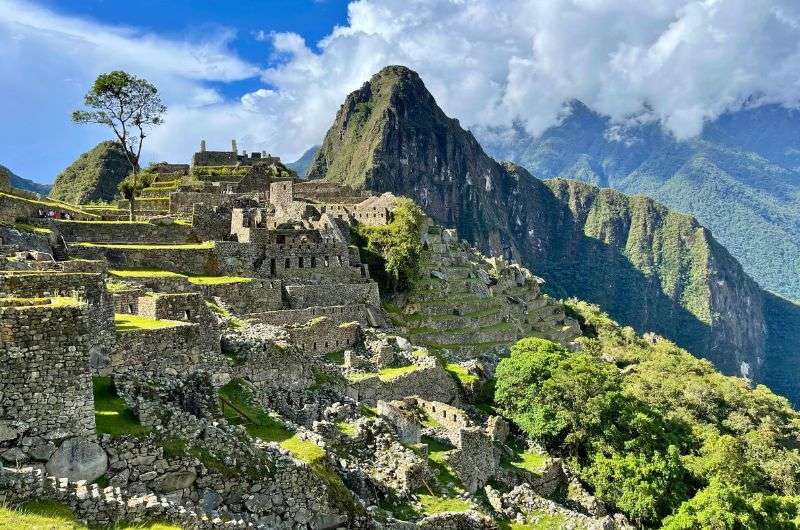
Unforgettable
Tip: Wondering when to visit? My article on the best time to visit Machu Picchu explains the pros and cons of wet vs. dry season—and why sunrise trips might not be worth the early alarm.
Is Machu Picchu a day trip from Cusco?
Technically, yes, but it’s not ideal. The logistics of driving, taking a train, and hopping on a bus take at least four hours one way, making it a long and exhausting day. If you’re looking for a jumping off point to explore the trail to Machu Picchu, Cusco is your best bet for logistics and acclimatization.
2. Explore Cusco: The gateway to Peru’s ancient wonders
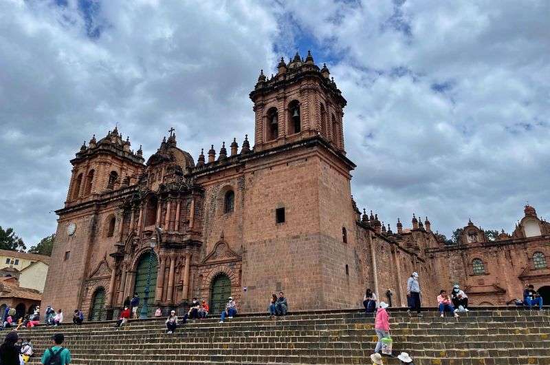
Cusco is a chapter of its own. Look at the majestic cathedral!
Jan’s verdict: Cusco is set in gorgeous scenery and offers so many things to explore. The city’s Plaza de Armas is stunning, one of the nicest central squares I’ve seen in South America, flanked by colonial architecture and the impressive Cusco Cathedral. A great thing about Cusco is that there are many day trips you can take using it as a base.

Cusco, once the capital of the Inca Empire, is a city steeped in rich history. Cusco is one of the few cities in the Americas worth more than a day of exploring (shoutout to Washington DC and Puebla, Mexico). Set in the most gorgeous scenery, it’s packed with things to do and a fantastic selection of restaurants.
What to do in Cusco for a day or three
Spend one day exploring the city center and another visiting the Inca sites on its outskirts. Then, add a day for a road trip through Sacred Valley! See my itinerary for 3 days in Cusco for this exact trip plan—everything is ready for you to head out on your own trip!
Oh, and another big hotel tip of mine, because I loved it there so much when I last visited Cusco: Hilton Garden Inn Cusco. It’s one of those places you keep comparing your next hotel to.
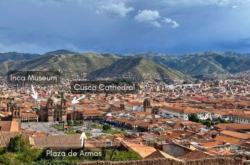
There are a lot of interesting things to see in Cusco
In Cusco, the Plaza de Armas is one of the prettiest squares in South America, with the massive Cusco Cathedral, which took 100 years to build. Had it not been prohibited, I’d have taken dozens of photos of the interior decorated with gold, silver and cedar wood.
Within the city center, don’t miss Qorikancha, the ruins of the Inca Empire’s most important religious complex. The Spaniards built a church on top of it (classic move), but you can still see remnants of the Temple of the Sun, once covered in pure gold.
A short trip from the city, Sacsayhuaman is a massive Inca fortress perched on a hill. It’s mind-blowing how they moved those enormous stones from a quarry 20 km away!
Cusco also has some fantastic museums. Start with the Inka Museum to get schooled on Inca culture, then visit the Museum of Pre-Columbian Art, which blew me away with its modern displays of art from the Mochica civilization to the Incas.
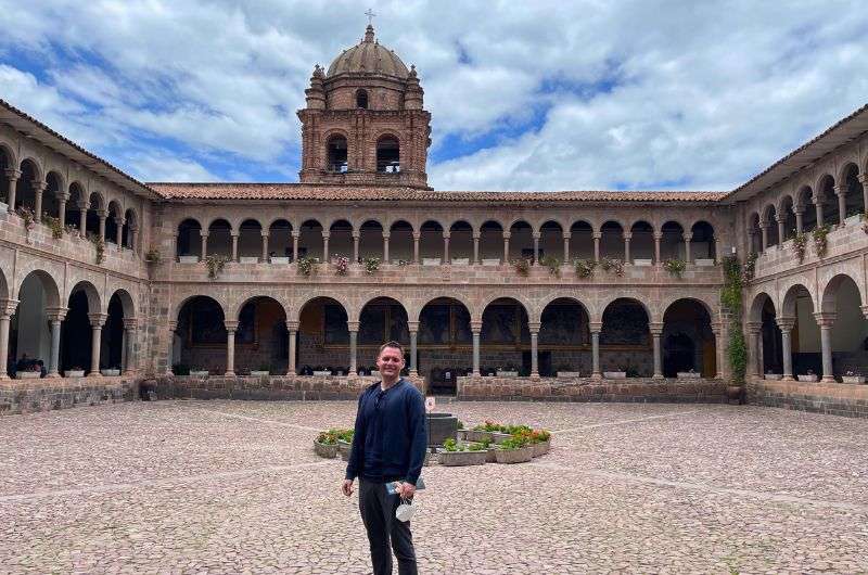
Me, playing guide at the Museum of Pre-Columbian Art
Use Cusco as a base for day trips
Cusco is the perfect base for day trips to the Sacred Valley, Rainbow Mountain, and Humantay Lake, or for starting your journey to the ultimate Inca destination: Machu Picchu.
It also makes sense to stay a while because of the altitude sickness you may experience. Take the first couple of days easy before heading out to even higher altitude destinations!
3. Conquer Rainbow Mountain and its colorful peaks
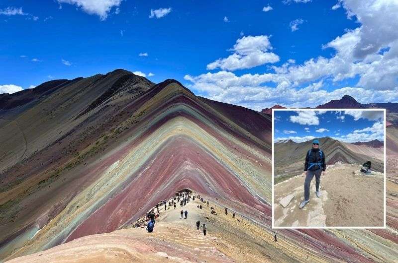
I loved Rainbow Mountain, but the altitude sickness was brutal
Jan’s verdict: I loved this trip so much despite it almost killing me. Ok, I’m exaggerating, but I felt absolutely miserable thanks to altitude sickness on this hike. The fact it’s still in the top 3 things to do in Peru says a lot.

Rainbow Mountain (Vinicunca) and its surroundings boast colorful stripes formed by minerals, though they aren’t as bright as Instagram might have you believe. The hike is challenging due to the altitude, but the views of South America’s Andes Mountains, especially snow-capped Ausangate, make it unforgettable.
Pro tip: If you’d like to avoid crowds, consider the Palccoyo alternative route for a less intense hike with similar rainbow-colored peaks. I talk about 3 different Rainbow Mountain hikes in my guide to Vinicunca and Palccoyo Rainbow Mountain.
Rainbow Mountain (and its colorful neighbors) has vibrant stripes created by minerals, though they aren’t as bright as Instagram might suggest. Is #nofilter still a thing? It should be, especially for natural sites.
The real magic lies in the challenge of getting there and the incredible scenery along the way. One look at snow-capped, 6,300 m (21,000 ft) Ausangate in the distance, and you’ll be glad you made the trip.
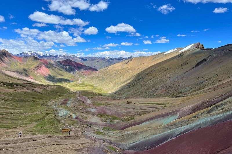
My photo from the Vinicunca hike (OG Rainbow Mountain). Just spectacular, isn’t it?
The main hike to Vinicunca starts at 4,600 m (15,000 ft) and spans 3 km (1.8 miles) with a 400 m (1,300 ft) elevation gain. Read up on altitude sickness beforehand—AMS is no joke! I powered through with a diet of coca leaves and tea and still suffered headaches and nausea.
Vinicunca isn’t the only rainbow-colored mountain. Palccoyo, an easier alternative, offers a 40-minute hike to three similarly striped peaks. The drive to any of these trails takes 3–4 hours from Cusco.
The most popular Cusipata route to Vinicunca is a 2-hour trek (one way), but the lack of oxygen at this altitude makes it feel much harder. By “lack of oxygen,” I mean 50% less, so prepare to chew coca leaves alongside dozens of other tourists taking millions of photos.
For details on the routes, prices, and tips, check out our full guide to Rainbow Mountain.
4. Discover the Sacred Valley’s Inca ruins and incredible scenery
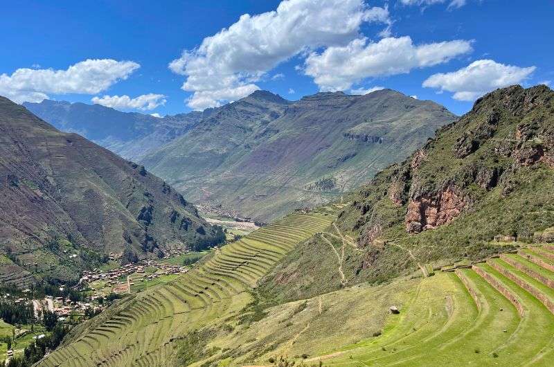
Sacred Valley
Jan’s verdict: Sacred Valley is not to be missed! Pisac, Ollantaytambo, and Chinchero are highlights, each offering a mix of traditional villages, vibrant markets, and impressive Inca ruins. The Sacred Valley is also a great place to acclimatize before tackling Rainbow Mountain or any other high-altitude treks.
The Sacred Valley, heart of the Inca Empire, stretches 60 km (37 miles) around the Urubamba River between Pisac and Ollantaytambo, carved deep into the Andes Mountains. Conveniently close to Cusco, it’s full of Inca ruins, jaw-dropping scenery, and rich Peruvian culture, making it a great place to acclimatize before tackling hikes in the area.
Check out my Sacred Valley travel guide for all of the top places to see, plus an explanation to the different Cusco Tourist Ticket options. But, to give you an idea of what you can see, here are the highlights of Sacred Valley:
Moray was the Incas’ agricultural laboratory, with round terraced depressions designed to experiment with microclimates. Nearby, Maras features thousands of salt evaporation pools, originally built by the Incas and still used by local families today.
Pisac, perched at 3,000 m (9,800 ft), offers views so good they rival the ruins themselves. They’re second only to Machu Picchu itself.
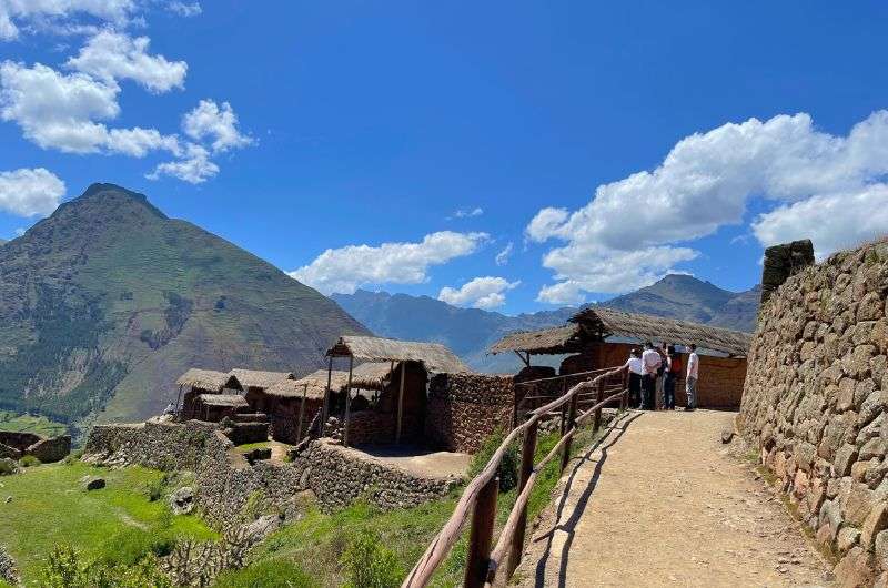
Ruins and views in Sacred Valley
For a traditional vibe, visit Chinchero, where locals in traditional dress fill the lively Sunday market. The town also boasts Inca ruins and a colonial church built on ancient foundations.
At Ollantaytambo, the best-preserved Inca city in Peru, you’ll find sprawling ruins, defense walls, and quarries. The sheer effort it took to move the stones for the Wall of the Six Monoliths—6 km (3.7 miles) from a mountain on the other side of the river—will leave you speechless.
Most visitors base themselves in Cusco, but the Sacred Valley has its share of fabulous resorts, or, if you’ve ever wanted to sleep in a pod haning on the side of a mountain. Now’s your chance! Vertical Sky Luxury Suites are calling your name.
5. Visit Paracas National Reserve: Where desert meets ocean
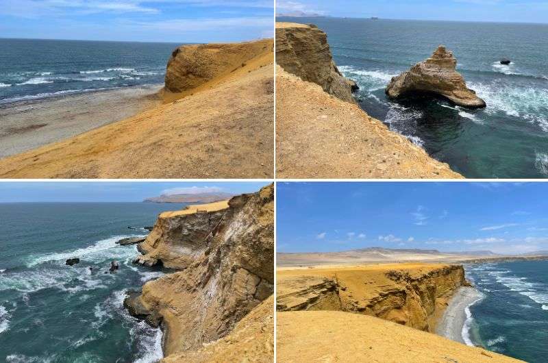
Paracas National Reserve
Jan’s verdict: Paracas National Reserve, a UNESCO World Heritage Site, offers stunning desert landscapes, turquoise ocean views, and a fun (but windy!) offroading adventure. The Peruvian coast here is unlike anywhere else in South America. Pro tip: Far superior to the more popular Islas Ballestas tours!

Located on a peninsula about 250 km (150 mi) south of Lima, the Paracas National Reserve is a UNESCO World Heritage Site and the highlight of the Paracas area. While many visitors come for the Islas Ballestas, I’m here to tell you that the reserve itself steals the show.
The desert’s vast beauty, set against the blue and turquoise ocean, is unforgettable. It reminded me of Namibia’s desert—just cooler (in temperature, not awesomeness). If you’re staying a few days, check out my full Paracas guide for more tips.
The reserve is full of fauna—birds, seals, penguins, whales, and yes, even snakes. I didn’t spot any snakes on my visit, which may or may not be unfortunate depending on your feelings about reptiles. I love them so I was a tiny bit disappointed.
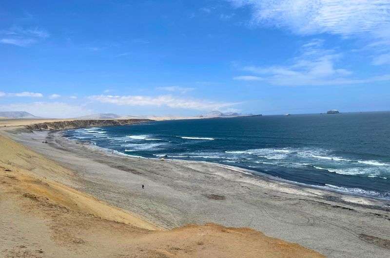
Loved it! One of the many beaches in Paracas National Reserve
How to explore Paracas National Reserve
The 23 km (14-mile) route through the reserve takes about 4 hours with plenty of stops along the way. Start at the interpretation center and museum, then follow the map you’ll get with your ticket to the six main highlights.
Most stops are just beaches or dramatic coastal viewpoints. I say “just,” but trust me, they don’t get old even after hours of exploring.
Playa Roja is a standout beach with deep red sand, created by ocean waves eroding the surrounding pink granodiorite cliffs. It’s one of the most unique beaches in Peru.
Swimming here isn’t ideal due to the chilly Humboldt Current, which is a shame because La Mina Beach is stunning. You’ll have to settle for admiring it from shore.
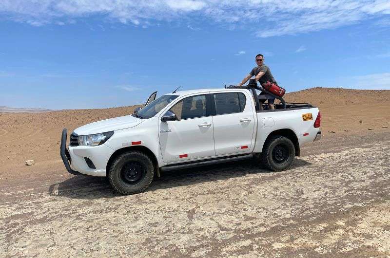
It's a long car drive in Paracas National Reserve. But so worth it!
Food in Paracas National Reserve
Good news for foodies: the reserve won’t leave you hungry. I had a fantastic meal at Cevichería La Tia Fela, a beachside spot with plastic chairs but top-notch food. The sea bass fish and chips were fresh out of the ocean (the fish, not the potatoes) and made my list of Peru’s best restaurants!
6. Take a boat tour to the wildlife haven of Islas Ballestas
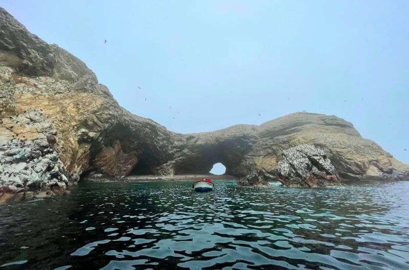
Nice trip, but I wouldn’t give it as much credit as it's generally given
Jan’s verdict: The Ballestas Islands boat tour is just slightly overrated. These rocky islands are home to seals, sea lions, and Humboldt Penguins. Sea lions are especially numerous, lounging on the rocks or diving into the water. It’s a short and relatively easy trip, though note you can’t get off the boat and the trip there and back is much longer than the actual island viewing time.
If you’re picturing palm tree-fringed islands and dreamy beaches, you’re not thinking of the right type of island. The Islas Ballestas are a small group of rock formations jutting out from the sea with tons of seals, sea lions, Humboldt Penguins, and I’ve never seen so many birds in one spot in my life. But no white sand, no foliage, and no possibility to lay foot on land (unless you’re a seal or a bird).
I’ve written a separate article about the Islas Ballestas, so check it out before you visit to know what to expect.
What the Islas Ballestas boat tour is like
To visit the Islas Ballestas, you’ll need to take an organized 2-hour boat trip from Paracas town. The rocks come in some fun shapes and have arches that the tourist boats will go under in order for everyone to get a good look (since you can’t get off the boats).
The trip out to the Islas Ballestas takes about 40 minutes on a speedboat. Then you have maybe half an hour “there”. You take lots of pictures and then spend 40 minutes on the boat trip back. The end.
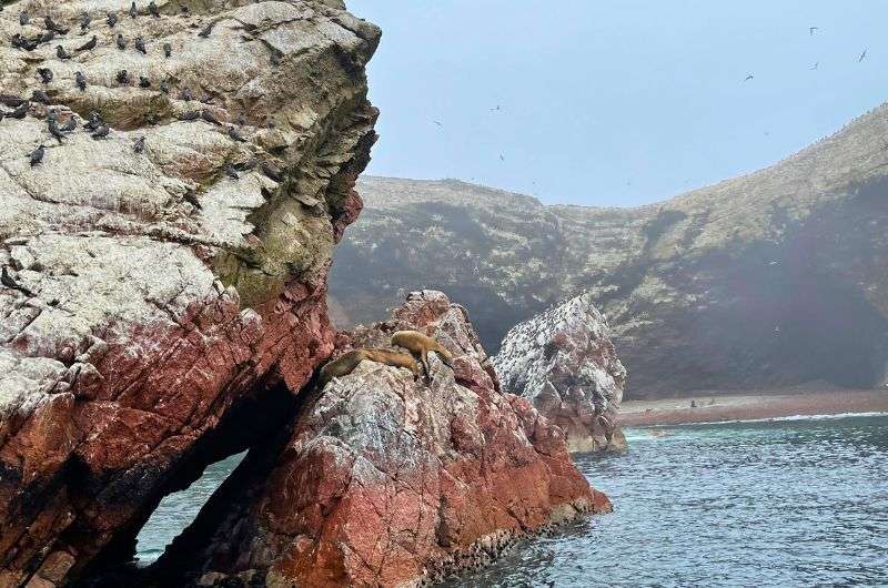
Beautiful photos from a beautiful spot @ Ballestas Islands
The Islas Ballestas are certainly nice and worth seeing if you have time and love marine animals. If you hate animals and get seasick just splashing around in your bathtub, I’d say look at the photos online and consider it seen.
The islands are used for guano mining
The Ballestas Islands aren’t part of the Paracas National Reserve, instead belonging to another reserve with an incredibly long name: La Reserva Nacional Sistema de Islas, Islotes, y Puntas Guaneras, basically a reserve for guano mining.
The Islas Ballestas are shitty—literally. What do you get when you have a big rock with thousands of birds hanging out on it year-round? Lots of shit. Guano. Poop. Once every few years, the guano layer of a meter or so (3 feet) is harvested by hand and used to make fertilizer. It takes months to finish the job. Where the birds shit during this time I don’t know, but wow. That’s impressive pooping.
Don’t get me wrong, it’s a nice little trip—the water is clear, the animals are fun, and we even saw dolphins on the trip there. But it isn’t the “Poor Man’s Galapagos” like I read somewhere on the interwebs.
7. Uncover Arequipa’s Charm and the Santa Catalina Monastery
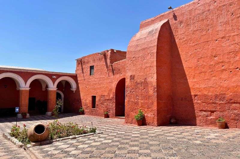
Santa Catalina Monastery in Arequipa
Jan’s verdict: Arequipa’s Plaza de Armas is the most beautiful in all of South America, with its sillar stone buildings and dramatic views of El Misti volcano. This city, with great day trip options, need to be on your radar.
You’ll be struck by the whiteness and cleanliness (possibly a side-effect of the whiteness) of Arequipa aka “The White City” from the moment you get there. It’s just pretty. Add a huge, symmetrical volcano in the background, and you’ve got yourself a top thing to see in Peru. Really, Arequipa seems so underrated, but it’s an amazing city, so don’t skip over it when planning your Peru itinerary.
The Stunning Plaza de Armas and Santa Catalina Monastery
The Plaza de Armas in Arequipa is the nicest I’ve seen in all of Latin America. It’s big, full of palm trees and manicured bushes, lined by the impressive Arequipa Basilica Cathedral and tons of shops and cafes. All white, naturally, thanks to the volcanic stone called sillar used to build the city.
The Santa Catalina Monastery is a city within a city, with streets, squares, and passages—even four distinct neighborhoods! Like the rest of Arequipa, the buildings are made of sillar, but the monastery is colorfully painted in reds, blues, and more. The contrast to everything else in Arequipa is quite fun.
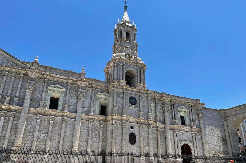
Basilica Cathedral of Arequipa
You might think of nuns as humble women with few possessions, but Santa Catalina was the Monaco of monasteries! Founded in 1579 by Doña María de Guzmán, a wealthy widow, it only accepted upper-class Spanish ladies who had to pay a hefty dowry (equivalent to $150k today) and bring items like paintings and statues.
Day trips from Arequipa
Arequipa is also a great place to base yourself for the day trips to the surrounding area. You can hike up the mighty El Misti volcano or go whitewater rafting on Rio Chili. It’s also where you’ll head to if you’re going to Colca Canyon (more on that below).
The Laguna de Salinas is part of Salinas and Aguada Blanca National Reserve, and it’s one of the most beautiful nature reserves I’ve ever seen! It’s epic and absolutely awe-inspiring. The mix of wetlands with tons of lamas, alpacas, and flamingos and the snow-covered peaks of the mountains above, with multiple volcanos towering above you, makes for a landscape like no other.
For details, read all about the best things to do in Arequipa.
8. Hike Huaraz: The hiking capital of the Peruvian Andes
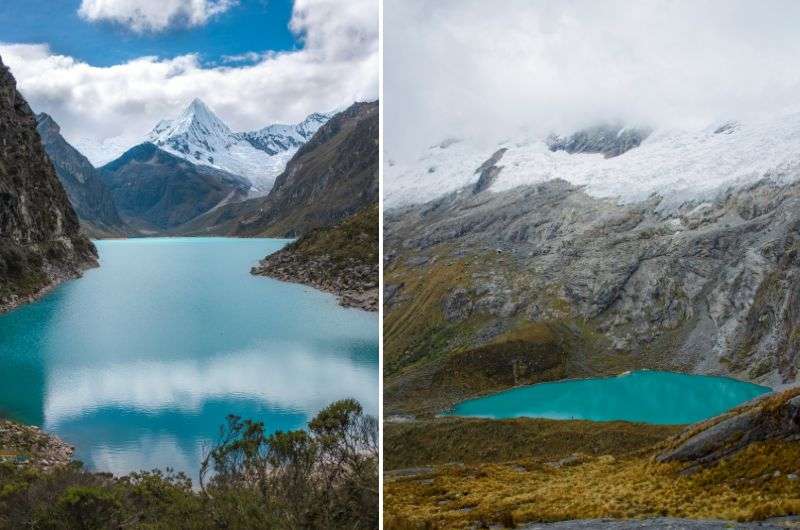
Huaraz hike
Jan’s verdict: If you’re a hiker, Huaraz in the Peruvian Andes is your paradise. Trails like the hike to Lake 69 offer unmatched views of glacial lakes and snow-capped peaks in the Cordillera Blanca.
Hey hiker! I see you over there, looking for your next mountain to climb. If you’re traveling to Peru, you need to put the country’s hiking capital, Huaraz, on your itinerary!
The Cordillera Blanca, the world's highest tropical mountain range, to the north of Huaraz, makes for a stunning backdrop to the city of 118,000. The jagged, snow-covered peaks are inviting and intimidating at the same time.
The iconic hike: Lake 69
There are 25 hiking trails in Huascarán National Park within the Cordillera Blanca, so you’ll need to figure out which one is the best for you, but I’ll mention the most popular: the hike to Lake 69.
I didn’t get a chance to do this iconic hike on my last trip, but it’s on my list for next time. Lake 69 is one hike that you have to do when you go to Huaraz and from what I’ve read, it lives up to the hype and then some.

This hike is moderately hard and quite long (about 5 hours)
The alpine lake is at an altitude of 4,600 m (15,000 ft), and the hike takes about 5 hours to complete. It is a moderately hard 14 km (8.6 miles) out-and-back route.
When you see photos of the turquoise lake surrounded by the grey rock of the mountain and the white snow of the peaks, you might feel the urge to climb all the way to the top of the glacier. And you can!
Some people actually use Lake 69 as an acclimatization trip for the more challenging ice climbing in the area. Nevada Mateo is one of the easier summits to reach even for those with no experience.
Since Huaraz itself is at an altitude of 3,000 m (9,800 ft) and everything else is even higher, you’ll want to acclimatize for a few days before attempting anything more than people-watching in town and perhaps one of the gentler walks, like Rajucolta Valley and Llaca Valley.
9. Walk through Chan Chan: The largest ancient adobe city in the Americas
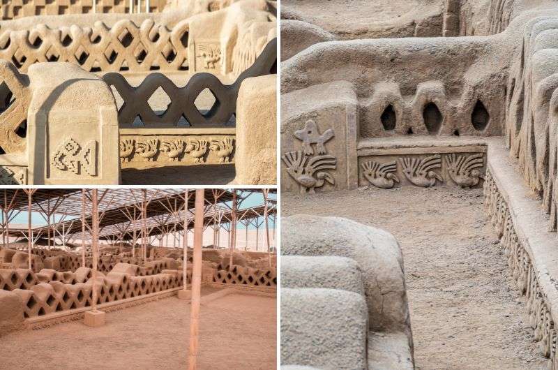
The Chan Chan ruins are not so well known, but they are very interesting and I definitely recommend a visit
Jan’s verdict: For me, Chan Chan is one of Peru’s most underrated ruins. It’s an awe-inspiring reminder of the Chimu Empire’s power and ingenuity. It’s a sprawling 20 km² site in an arid location, and ongoing restoration highlights just how fragile this UNESCO World Heritage Site really is. Chan Chan is a must-see for anyone fascinated by ancient civilizations.
For more fascinating details about Chan Chan, check out my guide to the best ruins in Peru.
Chan Chan was the capital of the Chimu Empire from roughly 900–1470 and, in its time, the largest city in the Americas. The Chimú then fell under Inca rule, apparently believing that the Incas were invincible. The Incas barely had to lift a finger to persuade the Chimú to submit to them—they cleverly cut off the city's water supply, forcing the Chimú to surrender.
UNESCO added Chan Chan to its Heritage List in 1986. Located a few kilometers west of Trujillo on the coast of Peru, 480 km (300 miles) north of Lima, it covers an area of 20 km², making it the largest adobe city in the Americas and the second-largest in the world.
Preserving a City of Sun and Sand
Chan Chan, which literally means Sun Sun, was likely named for its sunny, dry conditions. These arid conditions helped preserve the city’s adobe structures over the centuries, though the site is vulnerable to extreme weather. Extensive restoration efforts are ongoing, with roofs now protecting parts of the site from rain.
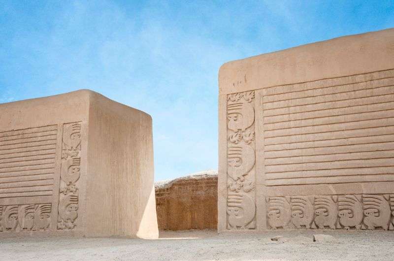
See the massive gate?
The city was split into ten walled palaces, each containing temples, residences, ceremonial halls, and more. The most interesting section is the central area, where the highest class lived. You’ll see reliefs and carvings on the walls, showcasing fish and birds—details the lower classes couldn’t afford to add to their flimsy homes, which haven’t survived.
Getting to Chan Chan from Lima
You can drive to Chan Chan from Lima, but it’s an 8-hour trip (even longer by bus—yuck). The best option is to fly into Trujillo, which has direct flights from Lima.
10. Experience Iquitos: The chaotic gateway to the Amazon
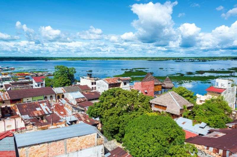
Iquitos—Gateway to the Amazon
Jan’s verdict: A lot of people skip Iquitos, because it’s not exactly easy to visit (no roads lead there), or very pretty. You’ll probably use Iquitos as a gateway to the Amazon and the Pacaya Samiria National Reserve, but if you have an extra night, take a day to check out the city, too. It’s… interesting.
Iquitos has a population of roughly half a million people, so it’s no village. Interestingly, there is no road leading to it—you can’t drive to Iquitos. You’ll have to either fly in from Lima or take a grueling 3–5-day boat ride from Yurimaguas like the locals do.
Fun fact: Iquitos is the largest city in the world that isn’t serviced by a road. It’s also known as the Capital city of the Peruvian Amazon.
First impressions: Chaos and charm
Iquitos isn’t exactly charming—at least not on first glance. The noise and craziness of motorbikes on the main roads, visible poverty, and stories of pickpockets might make you hesitant to explore. But give it a chance!
In the city center, you’ll find magnificent mansions (often a little run down) mixed with simple shanty-town huts by the river. The Plaza de Armas, filled with palm trees, is a good spot to take in the hustle and bustle—if you’re in the mood to embrace it.
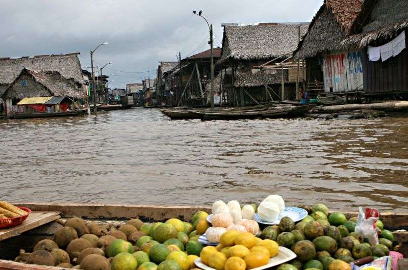
Belen Market is a true adventure (and just like any adventure, there are good and bad parts to it)
Take a walk on the Tarapaca Malecon, a manicured promenade near the main city square. It offers cafes, restaurants, and great views of the river and the stilted houses built on and around it.
A word of warning about Belen Market
The Belen Market is infamous for pickpockets—and yes, that includes monkeys trained to snatch wallets and cameras. Add in the animal trafficking happening here, and for me, it was a hard no.
If you want to counter the market’s impact, hop on a short boat ride to the Pilpintuwasi Animal Rescue Center. This group works to combat animal trafficking through education, rescue, and rehabilitation.
There are other rescue centers in the area but do your research—some are more about exploiting animals than actually saving them.
11. Explore Pacaya Samiria: Peru’s Amazon rainforest at its best
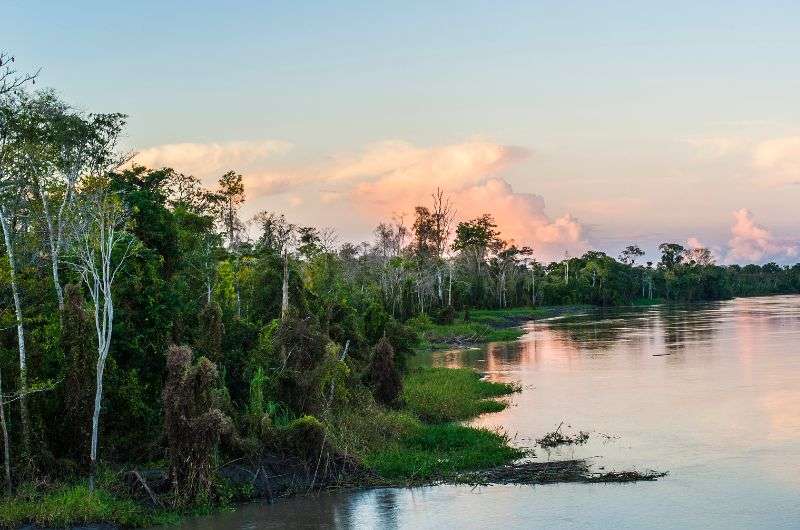
Peruvian Amazon Rainforest
Located deep in the Peruvian Amazon Rainforest, this reserve offers incredible biodiversity, from pink river dolphins to piranhas. Whether you choose a jungle lodge or a luxury river cruise, exploring the Amazon Rainforest here is unforgettable.
Located deep in the Peruvian Amazon Rainforest, the Pacaya Samiria National Reserve is a biodiversity hotspot teeming with life, from pink river dolphins and piranhas to sloths, jaguars, and medicinal plants. Covering 20,800 km² (8,000 square miles), it’s just a fraction of the massive Amazon jungle, but it’s packed with incredible experiences.
The activities here are almost endless: swimming with pink dolphins, fishing for piranhas, releasing baby turtles into the river, trying survival courses, meeting locals, or detoxing in the heart of the jungle.
When you look at Peru’s most-visited spots, it can feel like everything is in Lima or further south. But zoom out, and you’ll find Peru’s northern section dominated by the vast Amazon Rainforest, with Pacaya Samiria as one of its crown jewels.
This triangular reserve lies between the Marañón and Ucayali Rivers, which join to form the Amazon River. About 40,000 people live within the reserve, alongside a huge variety of wildlife. Thirty rangers work to balance the needs of the local communities and the protection of the flora and fauna.
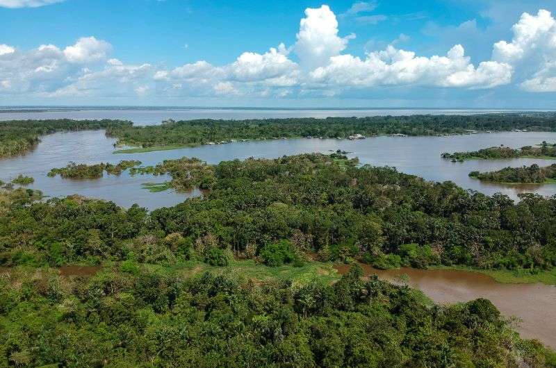
Pacaya Samiria National Reserve
How to get to Pacaya Samiria National Reserve
The most popular way to reach Pacaya Samiria is to fly from Lima to Iquitos, a 1.5-hour direct flight. From there, you can venture deeper into the jungle.
Where to stay: jungle lodges or luxury cruises
You’ll have several options for exploring Pacaya Samiria, like booking a multi-day stay at a jungle lodge, which offers deep-jungle experiences with the comfort of bungalows to keep the creepy crawlies away.
Or, hop aboard a luxury river cruise and enjoy fine dining, glass-walled rooms with jungle views, and excursions that take you off the boat and into the wild.
For the adventurous, there are also simpler options like camping at one of the reserve’s 15 campsites or combining lodge stays with a night under the stars.
12. Go sandboarding or relax at Huacachina desert oasis
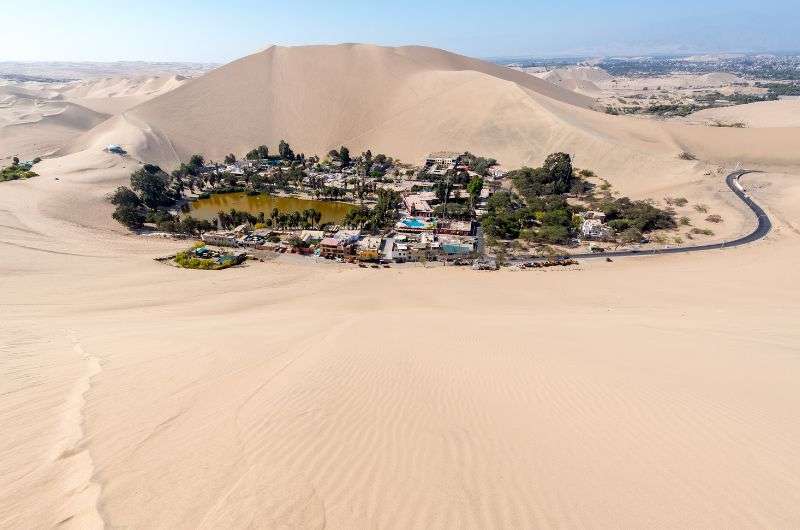
Visit the Huacachina Oasis
Jan’s verdict: Huacachina is fun, but let’s be real—it’s not the bee’s knees. Sure, the sandboarding, dune buggies, and sledding are a blast, and the sunset views from the dunes are genuinely special. But here’s a fun (or not-so-fun) fact: the oasis isn’t even natural anymore. They have to pump water into it to keep it from drying up. So, don’t expect some untouched desert paradise.
One of the top things to do in Peru is sandboarding on the mighty dunes, and the best spot for that is near Paracas at a literal desert oasis—Huacachina. A small town has popped up around the oasis with several eating and sleeping options and, of course, plenty of sand adventure outfits.
Sandboarding, dune buggies, and more
Besides sandboarding, you can hop in a dune buggy and swish around the sand. But fair warning—it’s a whole lot of sand in your face and a bumpy ride that’ll have you jumping out of your seat. Unless you enjoy sand “waves,” maybe stick to the board. You can also ski or grab a sand sled if you’re looking for alternatives.
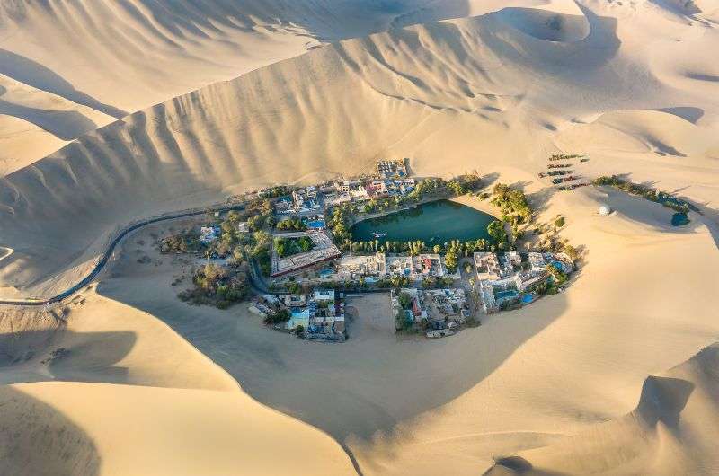
You can have a lot of fun on the sand dunes surrounding Huacachina. For example, try sandboarding!
Tip: Dito Sand Xsports, founded by four-time sandboarding world champion Dito Victor Chavez, is one of the best operators. Their guides are professional, friendly, and know their stuff.
Swimming in the oasis isn’t safe, so don’t do it—even the locals warn against it and they are some tough cookies, so you better trust them.
Instead, rent a paddle boat or just sit on top of the dunes overlooking the oasis. Plan your visit around sunset for an unforgettable view as the desert glows in golden light.
13. Visit Lake Titicaca and the floating islands of the Uros people
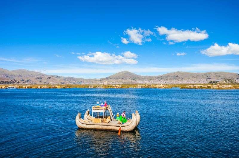
Lake Titicaca
Jan’s verdict: Lake Titicaca, the highest navigable lake in the world, is an essential stop on your Peru trip. The floating islands of the Uros people are a fascinating highlight. Made entirely of reeds, these islands are an engineering marvel and offer insight into the lives of local indigenous communities.
Lake Titicaca is the highest-altitude large lake in the world at 3,800 m (12,500 ft), stretching 190 km (120 miles) long, 80 km (50 miles) wide, and up to 280 m (920 ft) deep. Sitting on the Peru-Bolivia border, the line runs right through the middle of the lake.
The birthplace of Inca culture
By legend, the supreme Inca god, Viracocha, emerged from the lake to create the sun, moon, stars, and the first Inca rulers, Manco Capac and Mama Ocllo, who founded the Inca Empire. With Inca ruins around (and in!) the lake, it’s considered the birthplace of Inca culture.
Puno, the lake’s central port, is called the folklore capital of Peru, renowned for its music and dance. Each February, the Festival of the Virgin of Candelaria showcases South America’s best dancers and musicians in an 18-day spectacle of elaborate costumes and parades.
The floating islands of the Uros
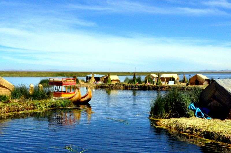
The floating islands of Uros tribes
Lake Titicaca isn’t just a big lake to admire—you can visit the indigenous Uros tribes living on it. These fascinating manmade islands, made entirely of reeds, float on the lake. The Uros, who predate the Incas, built the islands after being unable to secure land by the lake.
The Uros welcome visitors with tours, handicrafts, and reed boat trips. Keep in mind they only receive a small portion of tour fees, so buying directly from them helps their community.
14. Fly over the Nazca Lines: Peru’s mysterious geoglyphs
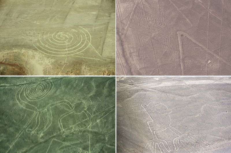
Nazca Lines, the mysterious lines with mysterious meanings
Jan’s verdict: The Nazca Lines are among the most mysterious things to do in Peru. These massive geoglyphs are best appreciated from the air, where you can marvel at their intricate designs. If you’re on a tight schedule (or lower budget), visit the Nazca Lines Viewing Tower for a ground-level glimpse.
The Nazca Lines are enormous geoglyphs “drawn” on the ground in the plateau south of Paracas. These designs include incredibly straight lines and shapes like animals and human figures, ranging from simple to complex. They were created by the Paracas culture (200–400 BCE) and the Nazca people (200 BCE–500 CE).
Located in a 10 x 4 km (6 x 2 mile) area between the towns of Nazca and Palpa, the lines are at least a 3-hour drive from Paracas.
How the Nazca Lines were made
The geoglyphs were created by removing the top layer of reddish-brown pebbles to reveal the lighter soil underneath. Thanks to the arid climate, the lines have been naturally preserved and are only occasionally damaged by weather or earthquakes.
Most of the lines are about 15 cm (6 inches) deep and 33 cm (13 inches) wide, with individual figures ranging from 400 to 1,100 meters (1,300 to 3,200 feet) in size.
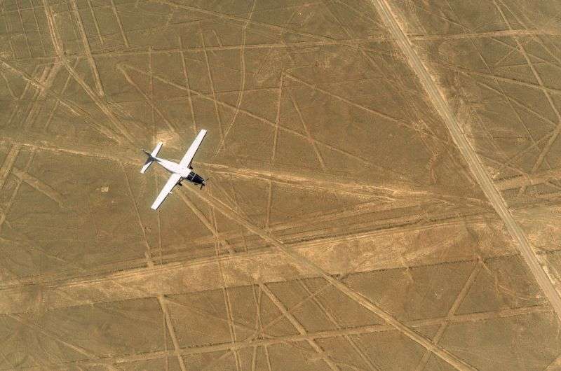
The best way to see the Nazca lines is from a plane
No one knows for sure, but most scientists agree the lines had some sort of religious significance.
How to see the Nazca Lines
The designs are so massive that they’re best appreciated from the air. If your time and budget allow, take a plane trip from Nazca’s Maria Reiche Airport for the full experience.
Alternatively, you can catch a plane from Paracas, though that just means a higher price and more time in the air before you get to the actual Nazca Lines.
For ground-level views, try these:
- The Nazca Lines Viewing Tower (Mirador de las Lineas de Nazca), located roughly midway between Nazca and Palpa.
- The Maria Reiche Museum, which offers a natural viewpoint and more insights into the lines.
I have a full guide to the Nazca Lines in Peru that includes not just practical information about visiting them, but also lots of hypothesis about their origins. It’s riveting.
15. Marvel at Colca Canyon and watch majestic condors
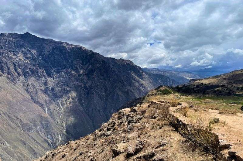
Colca Canyon
Jan’s verdict: Colca Canyon is nice. The condors were definitely a highlight—big, ugly-headed birds with a wingspan that could blot out the sun (or close enough). But the canyon walls are so close together that it just looked like… mountains. Majestic, sure, but in Peru, majestic mountains are kind of the norm. So, while it’s worth a visit if you’re in Arequipa, it’s not the jaw-dropping wonder I was expecting.
For detailed tips on visiting Colca Canyon, check out my Arequipa guide.
Colca Canyon plunges 3,400 m (11,155 ft) into the Andes, making it nearly twice as deep as the Grand Canyon. While Cotahuasi Canyon, also in Peru, edges it out as the local champion, Colca still impresses with its size, beauty, and majestic condors soaring overhead. But…
Is it worth the hype? Not entirely
Not entirely. Colca Canyon is undeniably beautiful, but for me, it didn’t live up to the hype. Maybe that’s because I only did a day trip from Arequipa instead of an overnight trek that gives you more time to explore.
Also, food poisoning didn’t help—but that’s a ‘me’ problem.
The long, bumpy 4-hour drive from Arequipa is exhausting and can set expectations sky-high. Once there, the canyon feels more like a narrow mountain valley, with angled slopes instead of the dramatic sheer drops you’d expect. Majestic mountains? Yes. But in Peru, majestic mountains are everywhere.
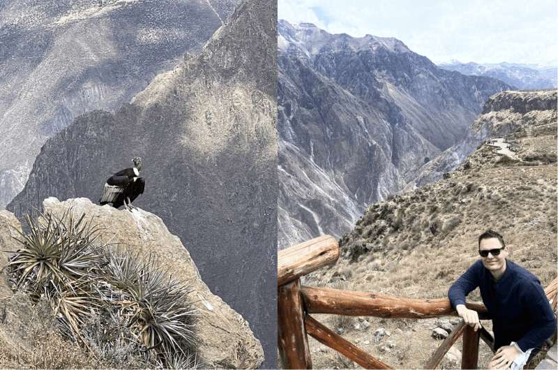
Condor (on the left) and me (on the right, in case you weren’t sure...)
Condor sightings: the real highlight
Condors are the main event here, and you’re almost guaranteed to spot them at the Mirador Cruz del Condor, the best viewpoint. These massive birds have a wingspan of 3 m (10 ft)—majestic in the sky, but let’s be real, not exactly pretty. I saw a few flying by and one chilling nearby, totally unbothered by its fans.
If you’re on an organized tour, expect a 3 am pick-up to catch the condors’ morning flight.
At 3,270 m (10,728 ft), the Cruz del Condor viewpoint is higher than Arequipa but lower than Cusco. While altitude sickness here isn’t as brutal as Rainbow Mountain, you still might feel shortness of breath. Coca leaves can help you manage it.
16. Discover Lima: A blend of culture, food, and history (but just for a day)
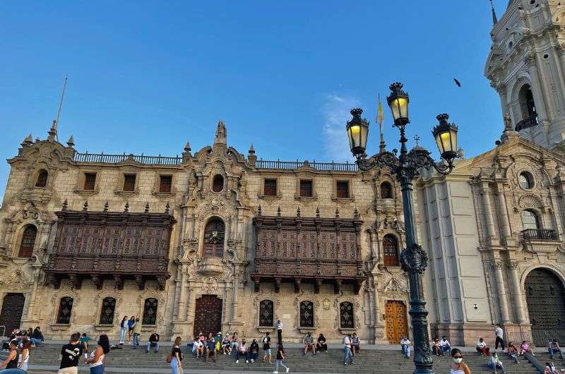
Plaza de Armas in Lima
Jan’s verdict: If Lima didn’t have an international airport, nobody would bother going. That said, if you’re passing through, it’s worth spending a day. Downtown Lima’s UNESCO World Heritage Site has some charming spots like the Plaza de Armas with its yellow buildings and old-school wooden balconies. And Miraflores? It’s modern, safe, and offers great restaurants, stunning coastal views, and sunsets that are actually worth the hype. So yeah, one day here is plenty, but make the most of it!
Here’s how to spend 1 day in Lima Peru. It gives you a trip plan with all the logistics of getting from the airport and a bit more about how I feel about safety in Lima.
Lima, Peru’s capital, sits roughly midway along the country’s coastline in a desert valley. The city ends abruptly on cliffs over the Pacific to the west and sprawls into the mountains to the east. With 10 million inhabitants, it’s the world’s third-largest desert city after Karachi and Cairo.
Lima’s UNESCO-listed historical center
Lima’s historical center, a UNESCO World Heritage Site, is known for its rich history and unique wooden box balconies, carved screens that once allowed wealthy women to discreetly watch the streets below. Think of it as pre-social media stalking, framed by beautiful yellow buildings around the Plaza de Armas.
Pro tip: I recommend staying in Miraflores, but if you prefer the old town vibe, choose a hotel near Plaza de Armas.
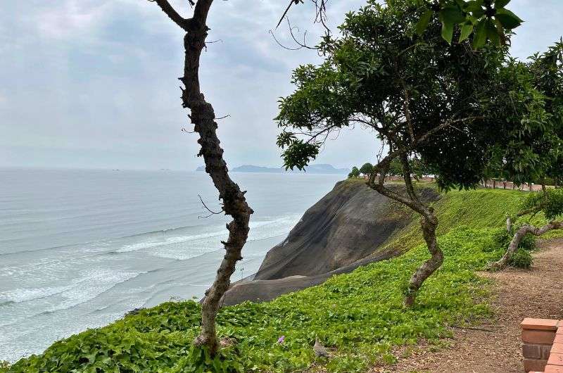
Miraflores is the best part of Lima
Miraflores: coastal charm and comforts
Miraflores is where Lima really shines. Perched on cliffs over the Pacific, its greenery-covered nets soften the rocky coastline into a welcoming stretch of modernity.
It feels a bit like Miami or San Francisco, with great restaurants, shopping, hotels, and spectacular sunsets along its coastal sidewalk. And for once, I didn’t feel like I’d get mugged!
A food and culture hub
Lima has some great museums, funky neighborhoods, and easy day trips, and it’s South America’s food capital. Unsurprisingly, some of the restaurants in Lima made my best restaurants in Peru list.
The Larco Museum is an absolute highlight of Lima. Set in a gorgeous mansion, it’s beautifully organized, with clear, informative descriptions that make you ooh, aah, and actually learn something about ancient Peruvian civilizations. I’ll say it: the Larco Museum is epic and non-negotiable.
While I don’t think Lima is worth more than a day, the Larco Museum makes that day unforgettable.
Sometimes, all you need to do is take the first step... I've filtered out the best hotels in Peru for you
Save it for yourself to come back to later, or share with your friends on social media!
I've already planned your ititnerary for the trip, complete with my travel tips.
You might also be interested in reading:
- The Best 3-Day Cusco Itinerary with Sacred Valley Day Trip
- A 2-Week Peru Itinerary: A Day-By-Day Trip Plan
- Top 14 Handpicked Luxury Hotels in Peru (With Prices)
- The 10 Best Ruins to Visit in Peru
This post contains affiliate links. I earn a small commission if you make bookings through my links, at no additional cost to you. Thank you for your support!




Comments | Thoughts? Give us a shout!