20 Best Day Hikes in Chile of Various Difficulties
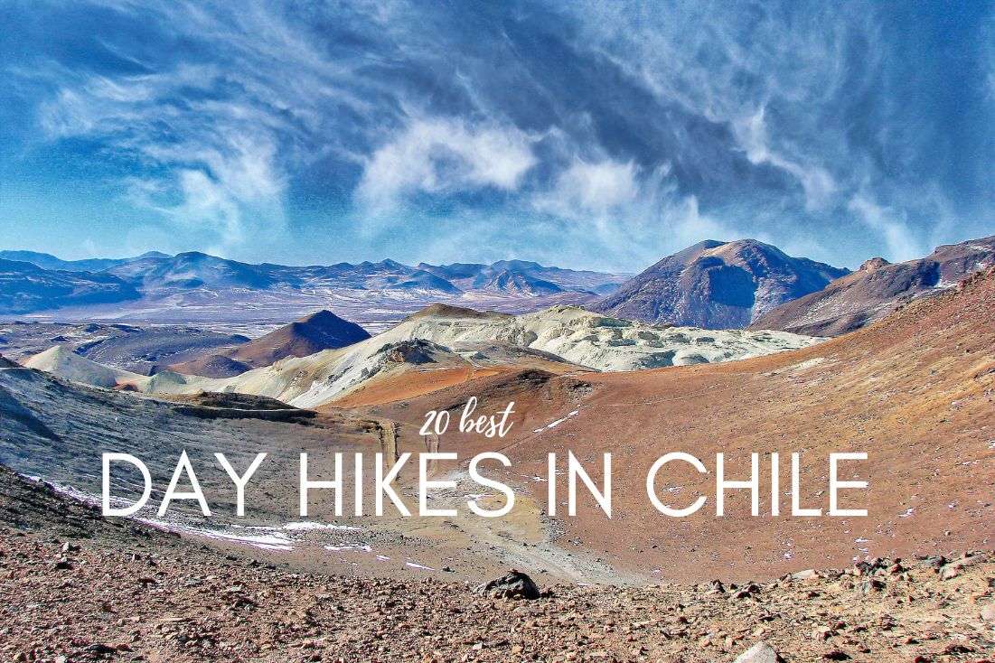
Chile is a Promised Land of all hikers. There are fairytale glens, challenging mountain peaks, crystal-clear lagoons, and many other marvels of nature to appreciate. Which are the best trails with the most wonderful views? I took the liberty of writing down the most interesting and thrilling hikes that I’ve enjoyed in Chile of various difficulty levels so that there’s something suitable for everyone. Even the family with small kids! Read on for detailed info on the treks, maps, tips, and more!
You might also be interested in reading:
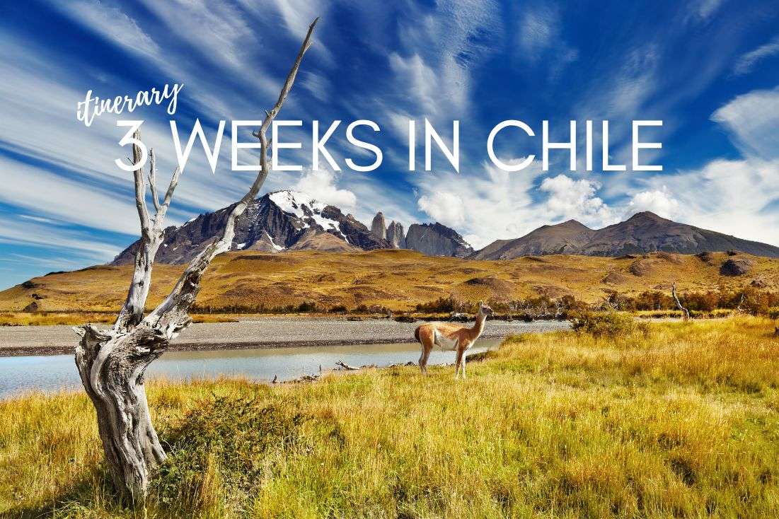
- 3 Weeks in Chile: The Ultimate Travel Itinerary
- All You Need to Know About Traveling to Chile: 15 Tips and Tricks
- All You Need to Know About Climbing Villarrica in 4 Steps
- 8 Highlights from my Visit to Patagonia
Best hikes in the Atacama
The Atacama Desert may be the driest (non-polar) place on Earth, but that doesn’t mean that there are no good trails. Just hit the road early in the morning, or later in the afternoon, and take enough water. If you’re interested in other than hiking, check out the article on Top 10 Things to do in San Pedro. Here are the best hikes with the top views.
- Accommodation: Hotel Pascual Andino | Hotel Desértica
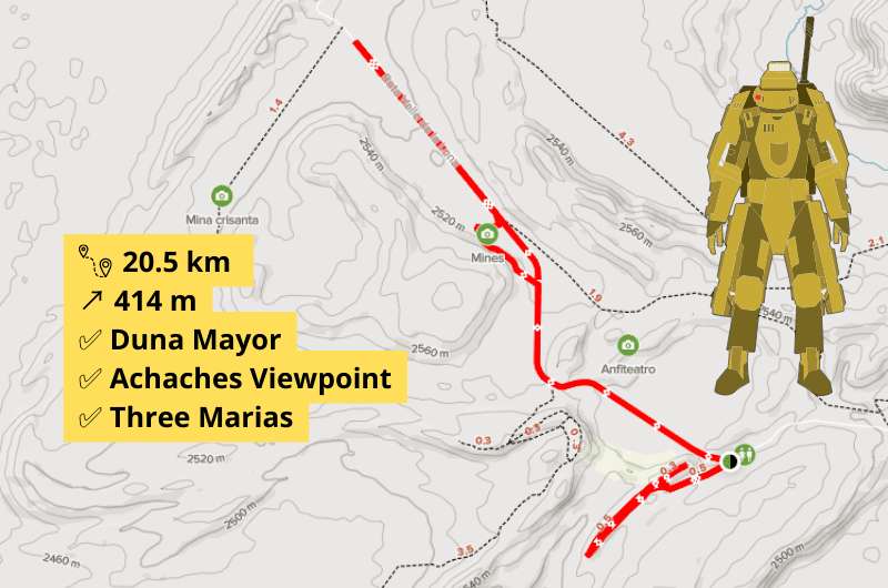
1. The Moon Valley Trail
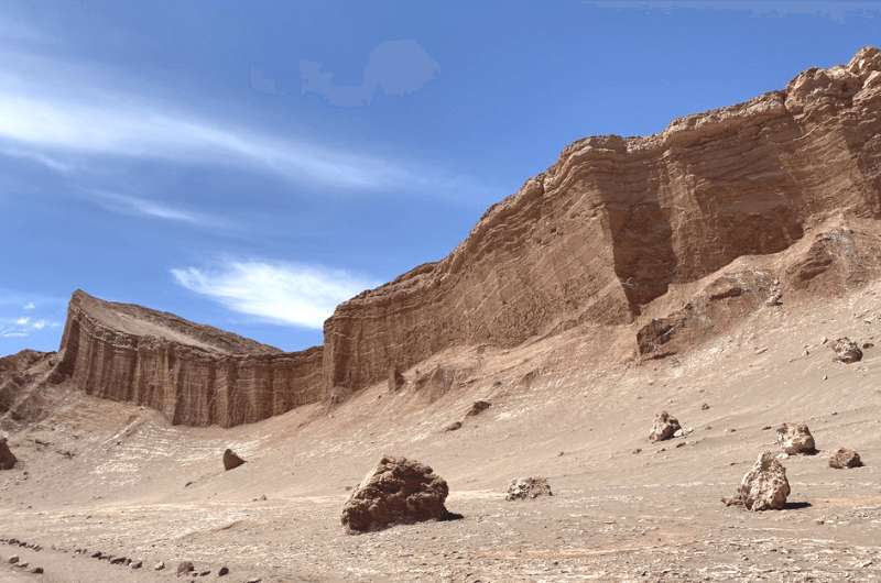
The Moon Valley Trail
- Difficulty: Hard
- Starting location: -22.94746, -68.29273
- Parking: free at the starting location
- Distance: 20.5 km (12.7 mi)
- Elevation gain: 414 m (1 358 ft)
- Time: 5-6 hours
Moon Valley trail
The Valle de la Luna trek wraps up all the best spots in the valley. Wondering what you can see in the desert? Well, just wait for it. The majestic dunes and rock formations flashed by all shades of pink, gold, and purple in the sunset is a jaw-dropping combination. I strongly recommend planning your trip for the afternoon, so that you will be coming back as the sun goes down and get a chance to take some incredible photos. Also, the evenings are quite chilly, which makes much better conditions for a walk. The roads are also suitable for cycling.
2. Pukará de Quitor – Devil’s Throat
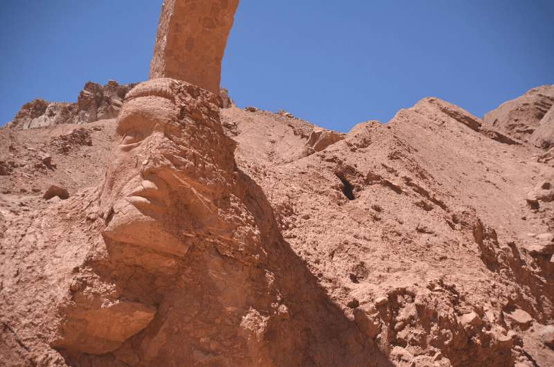
Devil’s Throat
- Difficulty: Hard
- Distance: 21 km (13 mi)
- Starting location: -22.910691, -68.200443
- Parking: There are free public parking spots 200 m (650 ft) from the starting point
- Elevation gain: 381 m (1 250 ft)
- Time: Approximately 6 hours
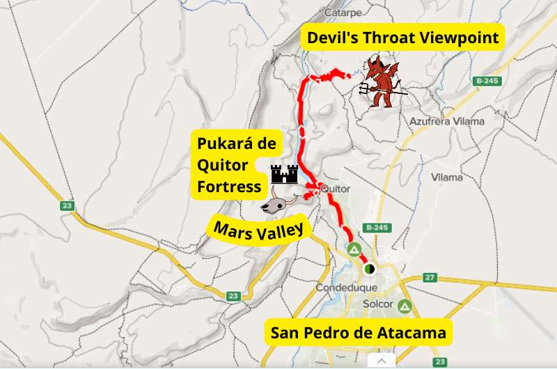
That's how you get to the Devil's Throat. If you dare to go there...
This nice hike starts at the edge of San Pedro. It walks you around Mars Valley, the Pukará de Quitor ancient fortress, and off to the Devil’s Throat Viewpoint. Most of the way winds along the San Pedro River canyon, but there’s no shade, so remember to bring enough water and a hat. You can also rent a bike or cut it back and do only Pukará de Quitor and Mars Valley version.
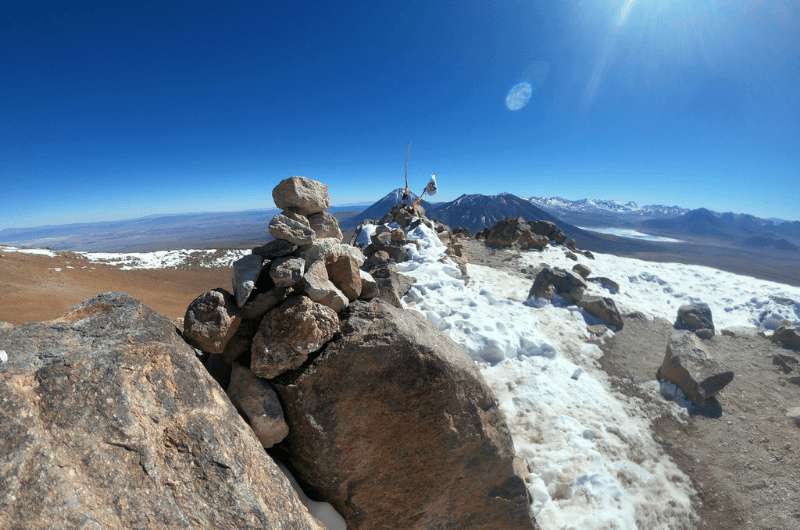
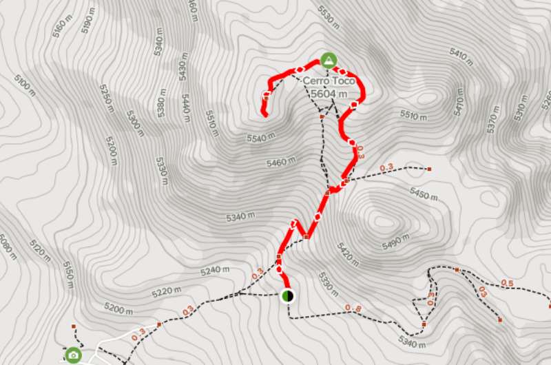
3. Cerro Toco Trek
Cerro Toco Trek
- Difficulty: Hard
- Distance: 4 km (2.5 mi)
- Starting location: -22.955963, -67.777188
- Parking: you can leave your car at the trailhead, but it better be a 4WD or you might have a hard time making it all the way there
- Elevation gain: 306 m (1 003 ft)
- Time: About 2 hours
Trek to Cerro Toco Peak
The trek to Cerro Toco Peak is quite challenging despite it being short. It starts at the altitude of 5 200 m (over 17 000 ft) which makes it hard because of possible mountain sickness. If you’re planning on taking this trek, prior acclimation to such high altitudes is essential! And I mean at least a week, anything less than that is not enough, you will want to go home early. All you need to know about mountain sickness is covered in the article The Big 3 of Altitude Sickness. Besides that, this trek is well marked, and you can enjoy cool views of the desert from the snow-capped peak.
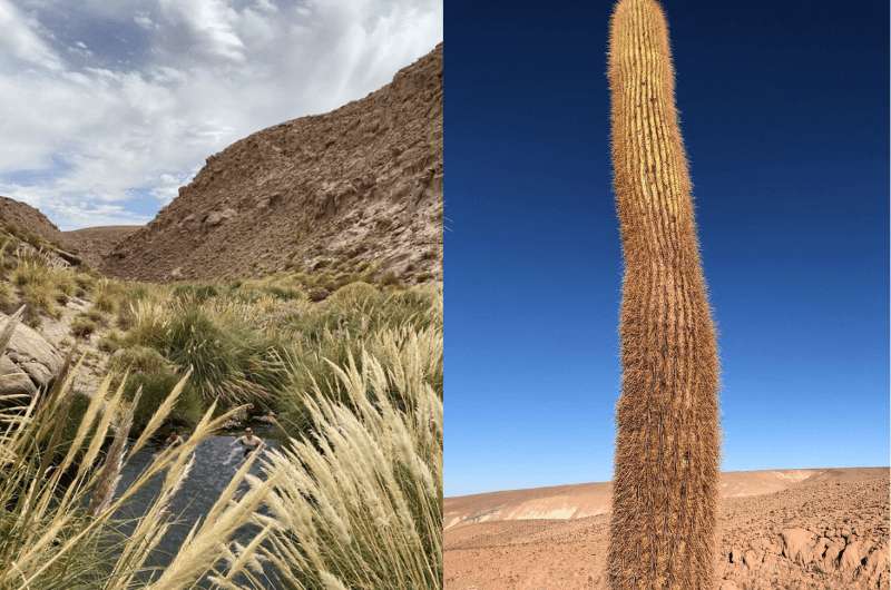
4. Puritama Hot Springs
Puritama Hot Springs
- Difficulty: Easy
- Distance: 10 km (6.2 mi)
- Starting location: -22.749690, -68.071283
- Parking: leave your car by the side of the road at the starting point
- Elevation gain: 365 m (1 197 ft)
- Time: Approximately 3 hours
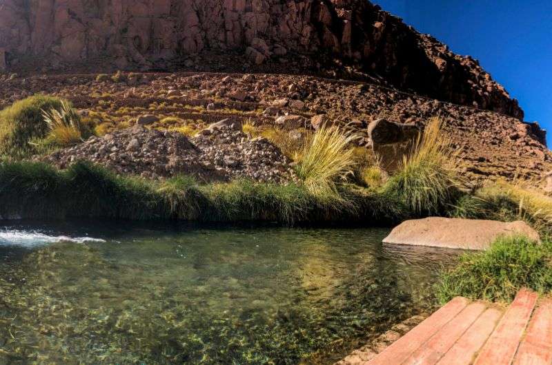
You can take a bath in hot springs pools!
Walk along the Puritama River Canyon, one of the few places in the Atacama Desert rich with flowers, cacti, and other plants. This hike is relatively easy and the path is surrounded by marvelous landscape. If you’re ready you can even jump in one of the hot springs pools (prior reservation needed). This hike is suitable also for families or less fit hikers.
Best Hikes Around Santiago de Chile
Santiago de Chile is metropolitan boredom, there’s nothing much to see, really. However, there are some good hikes in this area… and the huge mountain peaks vistas are the best. Also, Valparaíso with its colorful murals and ocean views is just a stone’s throw away. Interested in the tourist highlights? Check my article on Santiago de Chile and Daytrips. If not, there are the most thrilling hikes.
- Accommodation: Hotel Magnolia |Boutique Hotel Castillo Rojo
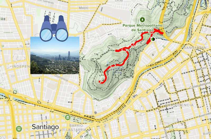
5. San Cristóbal Hill
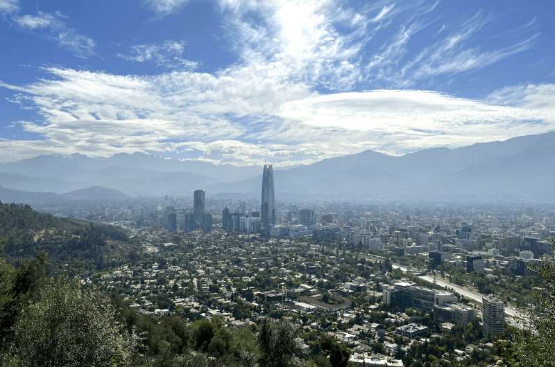
San Cristóbal Hill view
- Difficulty: Easy
- Distance: 9 km (5.6 mi)
- Starting location: -33.415231, -70.617531
- Parking: there’s a parking lot about 600 m (2000 ft) down the road (or improvise since this hike starts in the city)
- Elevation gain: 246 m (807 ft)
- Time: Approximately 45 minutes
That is where the San Cristóbal Hill lies
Right in the heart of the Chilean capital lies San Cristóbal Hill offering a birds-eye view of the city with the massive mountain range in the backdrop. The hike to Cerro San Cristóbal is relatively easy and rewarding. And a great option if you have a few hours to kill in Santiago.
6. Valparaíso City Circuit
- Difficulty: Easy
- Distance: 5.8 km (3 mi)
- Starting location: -33.048430, -71.622603
- Parking: park on the side of the road and off you go!
- Elevation gain: 181 m (594 ft)
- Time: Approximately 2 hours
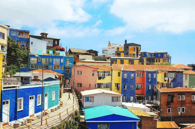
Valparaíso City
The artistic colorful Chilean version of San Francisco boasts many hidden gems in its streets worth discovering. Take this Valparaíso City Loop hike to check all the cool places off your list. There are many selfie spots on the way with perfect scenic views of the city and the ocean. Set off in the morning to avoid the tourist crowds and make the most of it!
7. San Francisco Glacier
- Difficulty: Medium
- Distance: 15 km (9.4 mi)
- Starting location: -33.48523, -70.03466
- Parking: park in the street where the trail starts
- Elevation gain: 669 m (2 293 ft)
- Time: Approximately 5 hours
Hello, travellers!
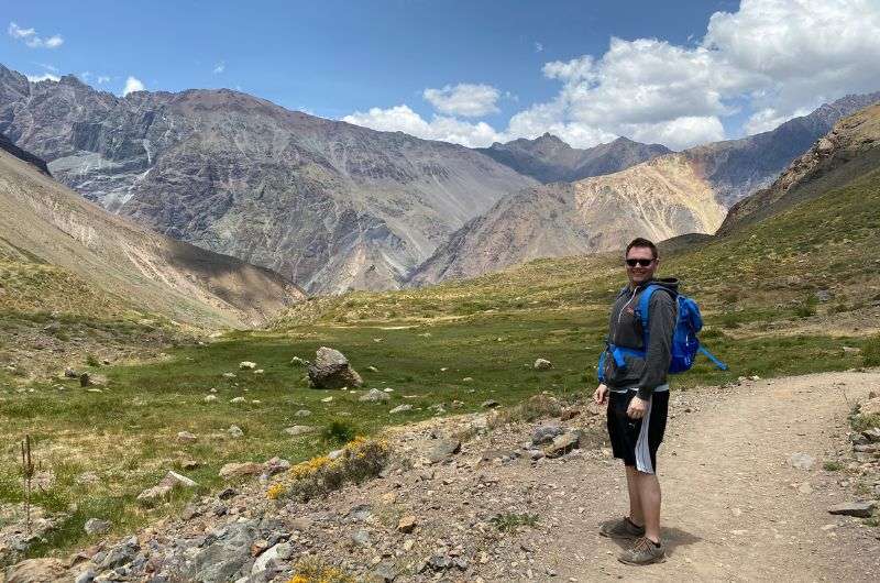
My personal favorite is near Santiago. Drive through El Maipo Canyon to Baños Morales, leave the car there and take the hike up to San Francisco Glacier. The path will lead you to a lagoon near the San Francisco Glacier with epic views of the peaks along the way. The path is well maintained and marked, so we had no trouble getting there. The first part of the trail is a bit steep but then it’s a piece of cake.
Our Top Tips for hiking in Chile:
- Always carry enough water supplies and some cash with you. There are often no refreshment possibilities and the national park’s admission are mostly accepted in cash.
- Feel free to ask the national park’s ranger for advice. They are super friendly and happy to help you out.
- There is every possible weather situation in Chile from north to south, remember that when choosing the right clothes for the trek.
8. El Yeso Dam
- Difficulty: Easy
- Distance: around 10 km (6 mi)
- Starting location: -33.663620, -70.081934 (or anywhere else by the dam)
- Parking: you can turn left off the main road at the coordinates that I used as the starting point and leave your car there, or choose from several other spots that you will pass on the way
- Elevation gain: ---
- Time: 2-3 hours
El Yeso!
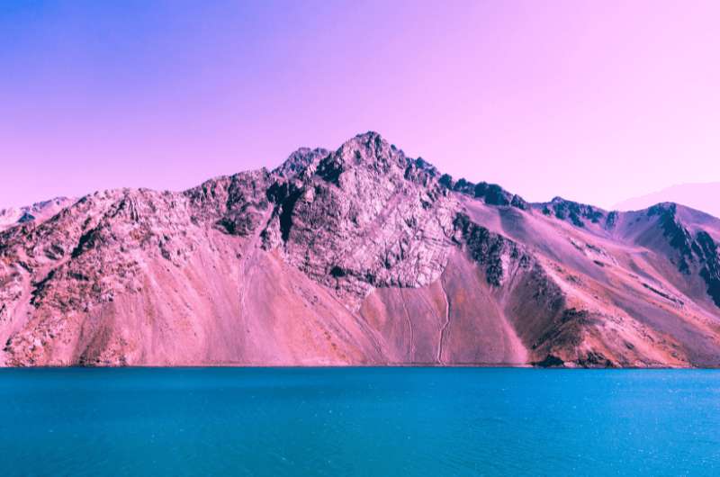
Technically, not exactly a hike. The map at Alltrails.com shows the way from the outskirts of Santiago to El Yeso Dam, which is a crazy long route. I suggest driving up all the way to the dam and taking a walk there. The setting is magnificent. The mountain range surrounding the reservoir gives more punch to the atmosphere. You can also try out the hike to the neighboring Laguna Negra. As this hike lies off the beaten track, you get a pretty big chance there will be no people there and you can enjoy a peaceful moment in the isolated wilderness.
Best Hikes in Lakes District
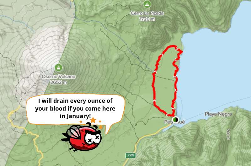
Here we go, Chilean Lakes District is arguably the best location for hiking. There are countless national parks with awesome views and well-marked trails. A piece of advice though, don’t plan it for January, unless you wish to be eaten alive by a huge flying blood-sucking helicopter. Explanation in the article about the best of Lakes District.
- Accommodation: Hotel Cumbres | Solace Hotel
9. Villarrica Volcano (Villarrica NP)
- Difficulty: Hard (mountaineering and climbing skills convenient)
- Distance: Approximately 3 km (1.8 mi)
- Starting location: usually at the Villarica Refuge
- Parking: you will probably arrive by bus with your tour group, so no need to park at the Refuge parking lot
- Elevation gain: 1 500 m (4 921 ft)
- Time: Approximately 4 hours
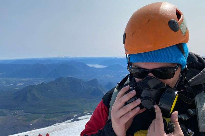
Villarica gave me a hard time. But I loved it!
More of a climbing trek, but I couldn’t possibly leave this out of the list. Chile has countless volcanos, but Villarrica is the real deal. The ascent is really demanding and difficult, so think twice before you decide to take it on. On the other hand, it was one of the most adrenaline-packed and rewarding experiences of my life. It is necessary to book a tour guide as it could be life-threatening to go on your own. I put together all the practical information as well as my impressions in the extra All You Need to Know About Climbing Villarrica in 4 Steps article.
- The price of the guided tour is set to around 112 000 CLP (135 USD), including the gear, backpacks, and snacks.
10. Sendero Sierra Nevada Trek (Conguillío NP)
Sendero Sierra Nevada
- Difficulty: Medium
- Distance: 11.4 km (7 mi)
- Starting location: -38.650430, -71.619633
- Parking: there are several parking spots at the starting point
- Elevation gain: 602 m (1 975 ft)
- Time: Approximately 4.5 hours
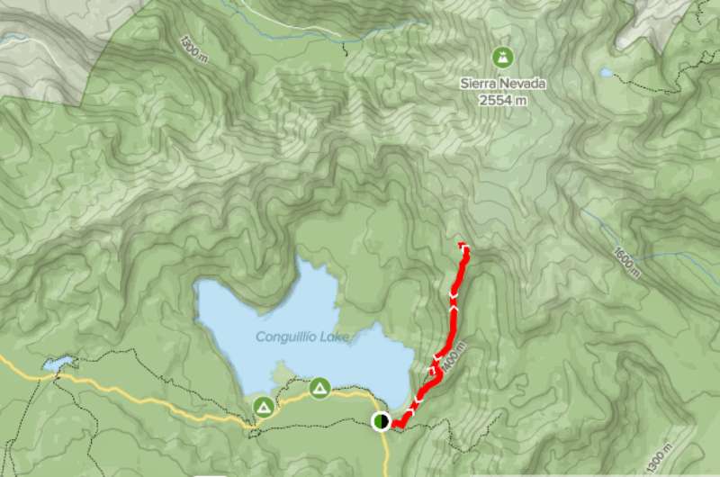
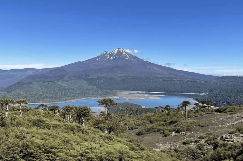
Conguillío National Park boasts numerous hiking trails, volcanic lagoons, ancient forests, and some rare species such as endemic Araucaria trees, or cordilleran Cypress. The Sendero Sierra Nevada Trek includes the best views of Conguillío Lake, Llaima Volcano, and the Sierra Nevada mountain range.
- Entrance price: 13 500 CLP (17 USD | 15 EUR)
11. Huerquehue Lakes Trail (Huerquehue NP)
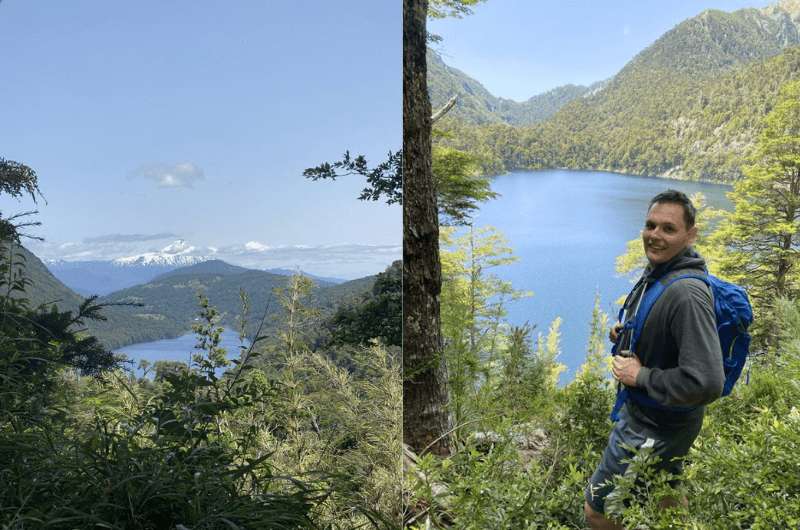
Huerquehue Lakes Trail
- Difficulty: Medium
- Distance: 10.5 km (6.5 mi)
- Starting location: at the Kiosko La Pulguita
- Parking: parking available at the kiosk
- Elevation gain: 689 m (2 260 ft)
- Time: Approximately 5.5 hours
Huerquehue Lakes Trail
Huerquehue is one of the oldest national parks in Chile, established in 1912. The Lakes Trail sums up all the highlights of the park. I particularly enjoyed the part further up the trail with several lakes next to each other and every single one unique in its beauty. We made it in 4 hours, but I imagine the route can get pretty muddy in wet weather, so bear that in mind, when planning the trip.
- Admission fee: 7 000 CLP (9 USD | 7.80 EUR)
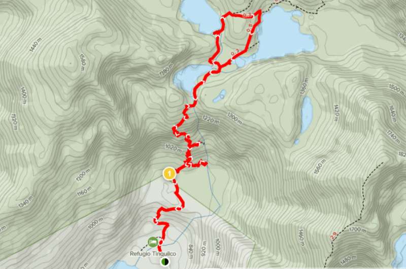
12. Sendero Los Alerces Loop Trail (Vicente Perez Rosales NP)
Sendero Los Alerces Loop Trail
- Difficulty: Medium
- Distance: 14.3 km (9 mi)
- Starting location: the trailhead is at the campground in Petrohue
- Parking: plenty of parking in the area, you can try by the campground or at the nearby beach
- Elevation gain: 328 m (1 076 ft)
- Time: Approximately 4.5 hours
Sendero Los Alerces hike trail
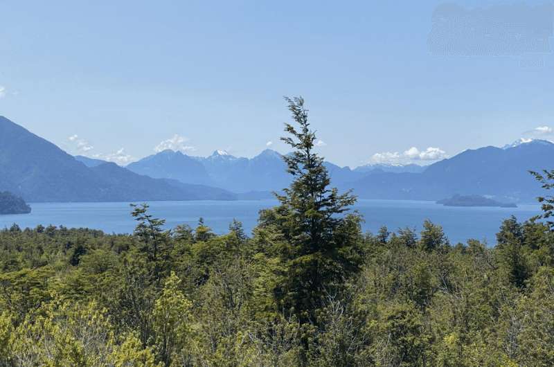
The Vicente Perez Rosales National Park stretches all the way to Argentina and it’s Chile’s first national park, established in 1926. Below the slopes of Osorno volcano lies the Todos Los Santos Lake. It’s important mainly thanks to the transportation route to Argentina. But it also makes a beautiful setting for a hike with views of Osorno. Too bad I didn’t know about the seasonal flies, so I had to wave my jacket above my head the whole way.
- Admission fee: 7 000 CLP (9 USD | 7.80 EUR)
13. Petrohué Waterfalls (Vicente Perez Rosales NP)
- Difficulty: Easy
- Distance: 1.8 km (1 mi)
- Starting location: -41.173186, -72.451021 (by the tourist office)
- Parking: there’s a large parking lot with at the tourist office with free parking
- Elevation gain: 38 m (125 ft)
- Time: Around 2 hours
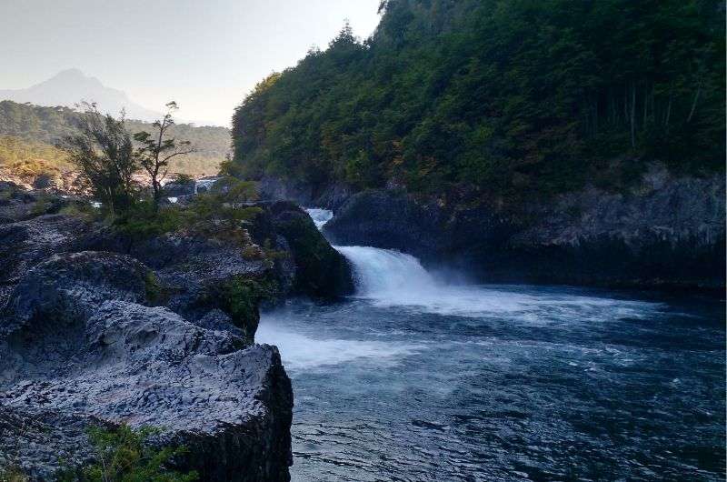
Petrohué Waterfalls
On the way up to the lake lies the Petrohué Waterfalls, one of the most beautiful waterfalls in the world. The waterfalls are a part of the Saltos del Rio Petrohué Park located right next to the Osorno volcano. That means the incredibly blue water runs down the black volcanic rock canyon carved by the lava from Osorno. We spent around 2 hours there on the Petrohué Waterfalls Trail, which is suitable for anybody. Now I understand why it’s one of the most visited places in Chile.
- Admission fee: CLP 3 200 (4 USD | 3.60 EUR)
14. Hike to Sargazo Lagoon (Allerce Andino NP)
- Difficulty: Easy
- Distance: 7 km (4.3 mi)
- Starting location: -41.508549, -72.621209
- Parking: parking spots at the starting location (there’s a little info booth there, too)
- Elevation gain: 358 m (1 175 ft)
- Time: Approximately 2.5 hours
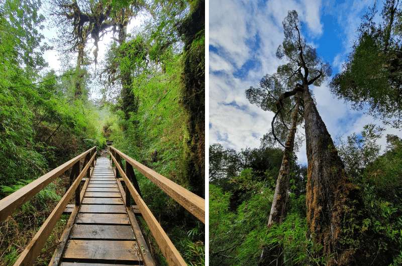
Hike through the Allerce Andino National Park
Allerce Andino National Park is a hidden gem for hikers. It lies around an hour’s drive from Puerto Montt yet it’s overlooked by the tourists. That would be a huge mistake though. The hike to Sargazo Lagoon is super simple and suitable even for small children (however not for a stroller as there are some stairs on the way). Walking through the forest on the wooden pathways you’ll feel like in the jungle until the spectacular view of the crystal-clear lake spreads out in front of you. Then, you will feel like Indiana Jones on his quest. The road forks after a few meters, but both ways are approximately the same distance, and both lead to the lake. If you turn to the left though, you’ll pass by the Allerce Milenario, a massive Patagonian cypress that is said to be almost 3 000 years old.
- Admission fee: 5 000 CLP (6.20 USD | 5.60 EUR)
15. Salto Río Chaicas (Allerce Andino NP)
- Difficulty: Easy
- Distance: 7.6 km (4.7 mi)
- Starting location: -41.593492, -72.593465
- Parking: easy parking at the trailhead
- Elevation gain: 109 m (358 ft)
- Time: Approximately 2 hours
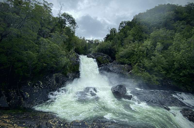
Salto Río Chaicas Trail
Same park, different part. Salto Río Chaicas hike leads along the river on the well-maintained trail. Approximately in the middle of the route, there are picnic tables, where you can stop and have a snack. As you can tell by its name, there are several lovely waterfalls along the way, and if you’re lucky, you can even spot an Andean fox.
- Admission fee: 5 000 CLP (6.20 USD | 5.60 EUR), paid per person for 1 day (if you manage to do more hikes in one day, you only pay once)
Best Hikes in Torres del Paine National Park
The living, breathing heart of the Chilean Patagonia is the Torres del Paine National Park. This is the place you must visit in Chile if nothing else. For me, this is the most beautiful NP in Chile. The best way to explore the area is hiking. And there’s a lot to explore in Torres del Paine. For more info about Torres del Paine and other thrilling activities such as Kayaking around Glacier Gray, read the 5 Things You Need to Know About Torres del Paine National Park.
- Accommodation: Hotel Vendaval | AKA Patagonia
Entrance fees
The entrance fees differ in low and high seasons:
High season (October 1-April 30):
- Adults: 21 000 CLP (25 USD | 22 EUR)
- Children: 6 000 CLP (7 USD | 6.30 EUR)
Low season (May 1-September 30):
- Adults: 11 000 CLP (13 USD | 11.60 EUR)
- Children: 1 000 CLP (1.20 USD | 1 EUR)
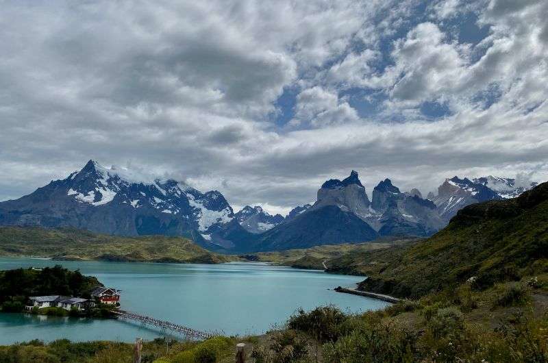
16. W Circuit Trek
W Circuit Trek
- Difficulty: Hard
- Distance: 69.5 km (43 mi)
- Starting location: Hotel Las Torres
- Parkng: at the hotel
- Elevation gain: 2 730 m (8 957 ft)
- Time: Approximately 4/5 days
W circuit Trek
If you wish to spend multiple days in the park, try the W Circuit Trek. It’s the ultimate hike with all the highlights of the park: Las Torres, Los Cuernos, Francés Valley, Paine Grande, and Grey Glacier. The whole trail is well marked, full of camping sites, mountain hostels, and hotels, it’s up to you how close to nature you want to be. The best time to hike is from November to March when it’s summertime. The wind is always killing it, but the weather will be more lenient.
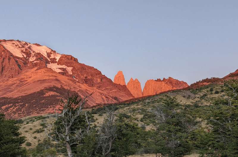
17. Las Torres Trek
- Difficulty: Hard
- Distance: 17.4 km (11 mi)
- Starting location: Hotel Las Torres
- Parkng: at the hotel
- Elevation gain: 990 m (3 248 ft)
- Time: up to 10 hours
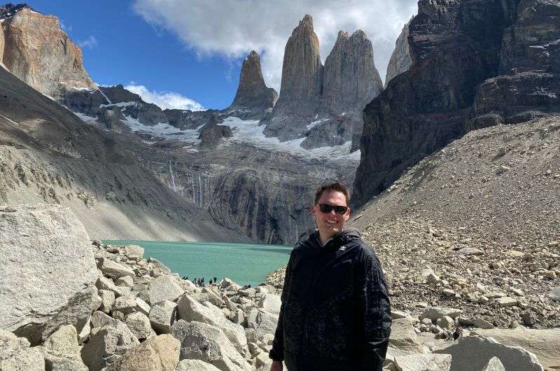
Me, catching breath on the Las Torres Trek
This is arguably the most famous trek in South America. It starts in front of Hotel Las Torres like the W Circuit Trek as it’s technically the initial part of it. The views along the way are meh, but the end of the road is jaw-dropping. The lake and the three “Towers of Paine” peaks are the most iconic landmarks of Torres del Paine, after which the NP was named.
First described as “Cleopatra Needles”, the three peaks are around 3 000 m (9 500 ft) above sea level, while you, standing at the bank of the lake are in some 850 m (2 788 ft). And why I’m telling you this? Well, because your brain goes mashed potato in there. It’s not able to process such a huge difference in altitude. I was standing there in awe, speechless. That’s how amazing it is. Check the map at alltrails.com.
18. Condor Lookout
- Difficulty: Easy
- Distance: 2.3 km (1.5 mi)
- Starting location: close to Camp Lago Pehoe
- Parking: there are some parking spots by the side of the road, or scout out around the camp, it’s easy to find a spot to leave your car
- Elevation gain: 189 m (620 ft)
- Time: Approximately 1 hour
The Condor lookout. Just amazing...
The Condor Lookout offers magnificent 360° views of Lake Pehoé and the Los Cuernos peaks. It is a bit steep in the beginning, but you don’t get such stunning views for free, am I right? Despite what every guidebook about Patagonia says, we had beautiful sunny weather, so we enjoyed the views to the fullest.
Moreover, you can see the Southern Patagonia Icefield from there. A huge ice plain that remained from the last Ice Age. We had sunny weather, so we could actually see and hear the rumble of the ice cracking and falling in parts. Now that’s an exciting experience.
19. Cuernos Lookout
- Difficulty: Easy
- Distance: 6.3 km (4 mi)
- Starting location: -51.064570, -72.997102
- Parking: you can leave your car at the starting point
- Elevation gain: 179 m (587 ft)
- Time: Approximately 2 hours
Cuernos Lookout
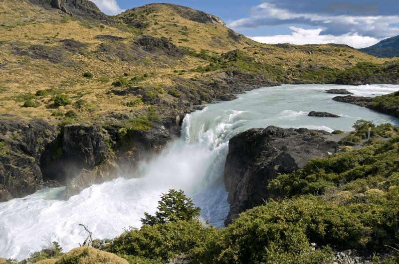
Only a little bit further up the road is the Cuernos Lookout, a truly spectacular hike that offers breathtaking views of the Salto Grande waterfall for almost zero effort. The short trail is almost flat and less frequented than the Condor Lookout, which makes it a great way to spend your time away from the crowds in a marvelous place surrounded by raw natural beauty.
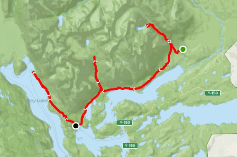
20. Camp Grey – John Gardner Bridge Trek
- Difficulty: Medium
- Distance: 9.3 km (5.7 mi)
- Starting location: Refugio Grey
- Parking: park at the Refugio
- Elevation gain: 373 m (1 223 ft)
- Time: Approximately 3 hours
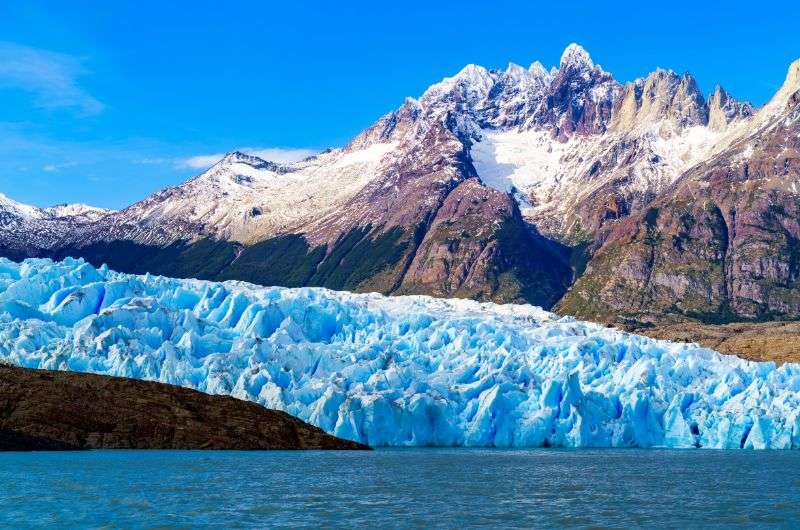
The Glacier Grey
And of course, you can’t miss out on the trek to Glacier Grey. How many times in your life will you get the chance to walk around a massive glacier? This hike is not as hard as some of the others, but I do not recommend this to people that are afraid of heights as there are three suspension bridges on the way. The path is rocky and some parts are pretty steep, so wear proper shoes.
On this journey, you get to marvel at the raw beauty of Lake Grey with floating chunks of ice from the glacier. If you’re lucky, you can even spot the condors circling above the lake. To get to the Refugio Grey, where the trail starts, you’ll need to book a ferry ride across Grey Lake.
Operating times:
- The ferry operates daily, but the times of the navigations vary according to season.
Prices:
- Round ticket: 80 000 CLP (95 USD | 84 EUR)
- One-way ticket: 70 000 CLP (83 USD | 74 EUR)
This post may contain affiliate links. We earn a small commission if you make bookings through my links, at no additional cost to you. This helps us keep this blog free, thank you!


Comments
Thoughts? Give us a shout!